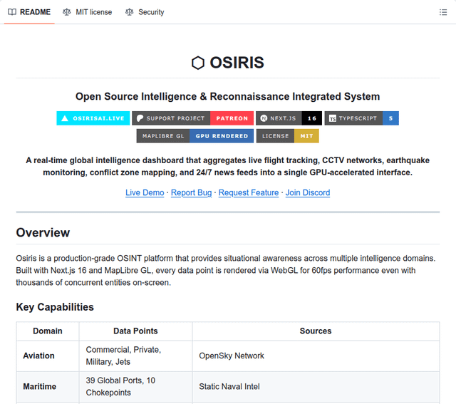
Set aside the "Palantir alternative" branding for a second, because that oversells it, and look at what this actually is: a genuinely functional, self-hostable situational-awareness map that pulls a surprising number of public data feeds into one WebGL interface. Osiris runs on Next.js and MapLibre, renders everything on the GPU so thousands of entities stay at 60fps, and, importantly, works out of the box without any API keys because its core feeds all use public, keyless sources.
What it actually aggregates, with real named sources:
– Live flight tracking from the OpenSky Network, real-time earthquakes from USGS, active wildfire hotspots from NASA FIRMS, and severe weather and space-weather from NASA and NOAA
– 17,000+ public traffic and webcam feeds from transport departments (TfL, Caltrans, WSDOT, Texas DOT and many more) and a hand-maintained public-webcam catalogue, each linked straight back to the operator that broadcasts it
– 24/7 live news streams from 23 global broadcasters, plotted on the map so you click a location to open the feed
– A sanctions and crypto-intelligence layer that cross-checks BTC and ETH wallets and WHOIS/IP lookups against the US OFAC SDN list via OpenSanctions, and a full sanctions search across persons, orgs and vessels
– A Telegram OSINT layer that reads public channel web previews (no bot token, no login), geoparses posts against a multilingual place dictionary, and pins them on the map
– A RECON toolkit with port scanning, DNS, WHOIS, SSL inspection and CVE lookups against the NVD
It is properly built for self-hosting: a one-command Docker compose, a prebuilt GHCR image, CasaOS metadata for one-click install, and a non-root ~220MB image. Credit where due, the README handles the camera layer responsibly, it stresses that every camera is publicly broadcast by its operator, links through to each source, and credits the catalogue it draws from.
Now the honest caveats, and there are a few that matter. First, "Palantir alternative" is marketing, not reality: this visualizes public feeds on a map, it does not do the data-fusion and analytics that name implies, so calibrate expectations to a very good public-OSINT dashboard. Second, not everything is live, some layers (conflict zones, maritime chokepoints) are static hardcoded intel despite the real-time framing. Third, and this is the big one for a security tool: the RECON toolkit includes a port scanner and vulnerability scanner, and scanning hosts you do not own or have permission to test is against terms of service and outright illegal in many places, so treat those tools as authorized-use-only. Fourth, on the project itself: the GitHub description carries a pump.fun crypto token address, the project is monetized through that and a Patreon (where the teased "special console" is, in their own words, currently just a cool UI), and it is promoted with heavy social-media engagement bait, so judge it on the working code rather than the hype or the star count.
Taken as what it really is, a clean, self-hosted aggregator of public intelligence feeds on one map, it is genuinely useful for OSINT hobbyists, journalists and situational awareness, and the fact that it runs keyless and self-hosted is a real plus.
MIT licensed, TypeScript, 9,904 stars and 2,049 forks as of writing, verified via the GitHub API, pushed to today.
https://i.redd.it/jh647gdt0urh1.png
Source: r/BestGitHubRepos · by /u/company_url_finder